
News Categories
News Archive
- Jul 2017 [ 1 ]
- Oct 2015 [ 1 ]
- Aug 2015 [ 6 ]
- Jul 2015 [ 5 ]
- Mar 2015 [ 1 ]
- Sep 2014 [ 7 ]
- Jun 2014 [ 5 ]
- Apr 2014 [ 2 ]
- Jul 2013 [ 7 ]
- Jun 2013 [ 8 ]
- Apr 2013 [ 2 ]
- Mar 2013 [ 1 ]
- Nov 2012 [ 2 ]
- Oct 2012 [ 1 ]
- Sep 2012 [ 3 ]
- Oct 2014 [ 1 ]
- Oct 2013 [ 1 ]
- Jul 2021 [ 1 ]
- Aug 2016 [ 4 ]
- Jul 2016 [ 3 ]
- Jun 2016 [ 4 ]
- Jun 2015 [ 2 ]
- May 2015 [ 1 ]
- Aug 2014 [ 9 ]
- Jul 2014 [ 11 ]
- Sep 2013 [ 1 ]
- Aug 2013 [ 9 ]
- Aug 2012 [ 14 ]
- Jul 2012 [ 13 ]
- Jun 2012 [ 3 ]
- May 2012 [ 2 ]
News
A dumping of wet snow this weekend - up high and in the east (50-60cm), then colder snow early next week.
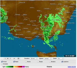
A low pressure system has formed near Adelaide, and has both tropical moisture and a cold pool of air.
The low will cross northwestern Victoria then southeast NSW on Friday night, before deepening just off Merimbula on the weekend. Alpine areas will see precipitation from Friday to Sunday - heaviest in the east Saturday night / Sunday morning. There should be just enough cold air to produce heavy snow above 1700 metres, but rain below.
A new cold front will cross Victoria on Monday, bringing a moderate amount of snow - but this time, throughout all alpine elevations.
Day |
Forecast |
Likely Snow |
|---|---|---|
Rest of Thursday |
Cloud thickening. A light spit of rain in the afternoon, increasing to persistent rain at night. N/NW winds, strong at times. |
1800m - 0cm 1500m - 0cm 1200m - 0cm |
Friday |
Persistent rain in the morning, turning to persistent snow up high during the afternoon, but rain continues lower down. NW winds, strong in the morning. |
1800m - 8cm 1500m - 0cm 1200m - 0cm |
Saturday |
Persistent snow up high - becoming heavy in the afternoon. Rain continues lower down. S winds, strong from the afternoon. |
1800m - 20cm 1500m - 0cm 1200m - 0cm |
Sunday |
Persistent snow up high, heavy in the morning. Rain continues lower down. All easing in the afternoon. Strong S/SW winds. |
1800m - 30cm 1500m - 0cm 1200m - 0cm |
Monday |
Snow showers, tending to persistent snow at night. SW then W winds, strong at times. |
1800m - 10cm 1500m - 0cm 1200m - 0cm |
Outlook:
Snow showers ease on Tuesday, as the front moves away and the next high comes in.
* Commentary above Courtesy of Jane's Weather. www.janesweather.com